Drones for Agriculture
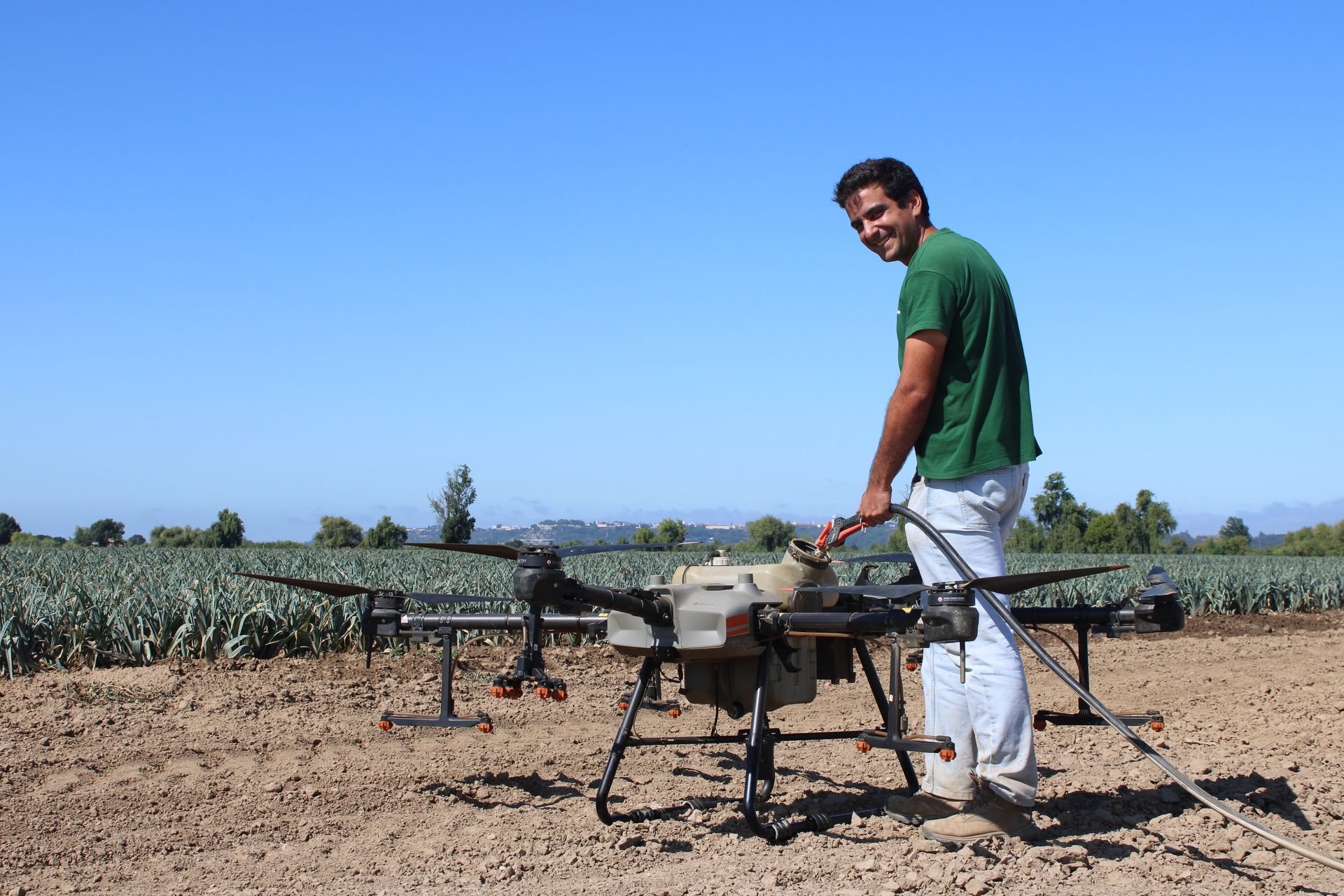
The safest and most efficient solution for agricultural applications
At Hubel Verde, we provide agricultural drone services for seeding, fertiliser application and crop monitoring.
Using this technology, we carry out field operations quickly, accurately and safely, even in hard-to-reach areas. Agricultural drones also enable early detection of crop issues, helping optimise resource use, reduce waste and improve the efficiency and productivity of farming operations.
Crop monitoring;
Precision aerial application;
NDVI mapping;
Variable rate application plans.
What our Drone Services include:
Certified operators | Precision aerial application | Flight planning
Discover your farm's potential with drone technology
Know how aerial monitoring and precision application can help detect issues earlier, optimise resources and improve the efficiency of your operation.
Our agricultural Drone range
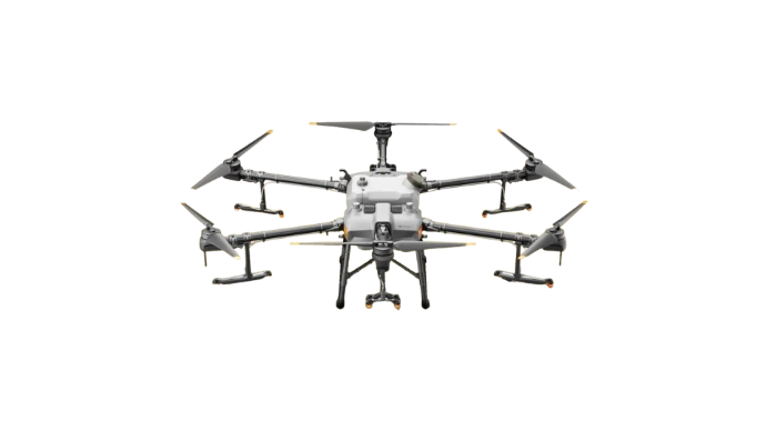
DJI Agras T30
- Capacity: 30 L liquid tank, 35 kg spreading tank;
- Maximum flow rate: 8 L/min (spraying), 40 kg/min (spreading);
- Spraying swath: up to 9 m, at a flight height of 3 m, with a droplet size of 130–250 μm;
- Spreading swath: up to 7 m, at a flight height of 3 m, with particle sizes ranging from 0.5–5 mm;
- Integrated RTK, front and rear radar, and binocular vision system;
- Flight time: up to 10 minutes;
- Ideal for fields smaller than 10–20 hectares or lower application rates.
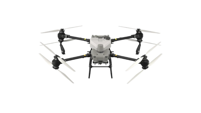
DJI Agras T50
- Capacity: 40 L liquid tank, 50 kg spreading tank;
- Maximum flow rate: 24 L/min (spraying), 108 kg/min (spreading);
- Spraying swath: up to 11 m, at a flight height of 3–3.5 m, with a droplet size of 130–250 μm;
- Spreading swath: up to 8 m, at a flight height of 3–3.5 m, with particle sizes ranging from 0.5–5 mm;
- Centimetre-level RTK positioning with omnidirectional obstacle avoidance;
- Flight time: up to 10 minutes;
- Ideal for fields between 20 and 30 hectares.
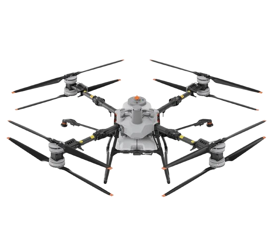
DJI Agras T100
- Capacity: 100 L liquid tank, 100 kg spreading tank;
- Maximum flow rate: 40 L/min (spraying), 400 kg/min (spreading);
- Spraying swath: up to 13 m, at a flight height of 3–3.5 m, with a droplet size of 50–500 μm;
- Spreading swath: up to 10 m, at a flight height of 3 m, with particle sizes ranging from 0.5–10 mm;
- LiDAR, Penta-Vision system and advanced obstacle avoidance;
- Flight time: up to 10 minutes;
- Ideal for fields larger than 25 hectares.
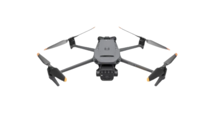
DJI Mavic 3M
20 MP RGB camera and multispectral camera (Green, Red, Red Edge and Near Infrared);
- Ground Sampling Distance (GSD): from 0.5 cm (at 10 m flight altitude) to 6 cm (at 120 m flight altitude);
- Integrated RTK for centimetre-level positioning;
- Flight time: up to 30 minutes.
Benefits of agricultural drone applications
Prevent soil
compaction
As drones never enter the field, they eliminate machinery traffic, preserving soil structure, water infiltration and root development.
Increase operational
efficiency
High work rates and efficient payload capacities allow large areas to be treated quickly while reducing labour requirements.
Detect crop
variability early
- Multispectral imaging and advanced sensors help identify differences in crop vigour, water stress and nutrient deficiencies before visible symptoms appear.
Improve application
precision
Apply only where needed, reducing input waste while increasing application accuracy and overall crop performance.
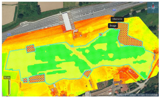
NDVI Mapping:
See what the eye can't. Act with precision.
NDVI (Normalized Difference Vegetation Index) is a vegetation index derived from multispectral imagery that measures crop vigour and plant health.
It enables growers to identify variability within fields, detect stress at an early stage and make better-informed agronomic decisions before problems become visible.
The result is more efficient crop management, optimised input use and improved productivity.
What is NDVI used for?
Identify areas with poor crop vigour
Detect water and nutrient stress
Support variable-rate fertilisation
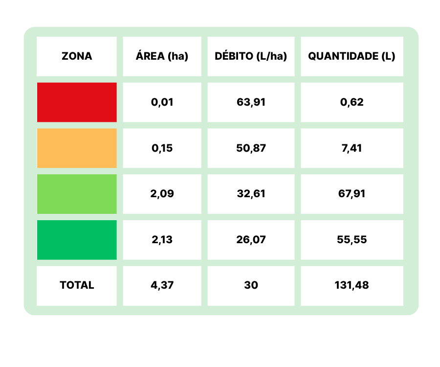
Map 1 - Example of prescription mapping
Recommended application table (related to Map 1)
Contact us
Do you have a question or need support for your crop? Send us your request and we will get in touch with you.
Specialized technical support
Quick and personalized response
FREQUENTLY ASKED QUESTIONS
Direct answers to your questions.
Agricultural drones are ideal whenever fast, accurate applications are required or when fields are difficult to access.
They are particularly valuable in high-value crops, helping improve operational efficiency while minimising soil disturbance.
Agricultural drones complement conventional spraying equipment, particularly in areas with limited accessibility, wet soils, steep terrain or where rapid intervention is required.